
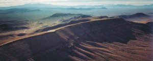


Geodetic Monitoring at Yucca Mountain
The geodetic monitoring of the Yucca Mountain Nevada Region is a collaborative project between the Nevada Bureau of Mines and Geology, University of Nevada, Reno, the California Institute of Technology Division of Geological and Planetary Sciences and the Harvard-Smithsonian Center for Astrophysics Radio and Geoastronomy Division.
The objective of the project is to perform geodetic monitor of the Yucca Mountain region with continuous Global Positioning System (GPS) measurements, thereby providing the public and the Yucca Mountain Project with independent scientific data concerning the use of Yucca Mountain as a potential high-level radioactive waste repository. The original network, comprising 32 GPS stations has recently been expanded to 46.
Since the first stations were installed in 1999, the continuous GPS observation network has provided and continues to represent an excellent data set for a number of studies, including: the identification of high crustal strain accumulation levels; connections between geology, seismicity and geodesy; and the accuracy of continuous GPS measurements.
Aside from the network forming the geodetic monitoring component of the Yucca Mountain Project, these sites are also a component of the wider Basin and Range Geodetic Network (BARGEN).
For questions or comments on web site contact: Geodesy Webmaster
Document URL: lweb.cfa.harvard.edu/space_geodesy/YUCCAMT/ym_index.html
Last Modified: Thursday, 01-Jun-2006 17:36:52 EDT